 Photo by Julien R / Pexels
Chasing Arctic Giants: A Cinematographer’s Guide to the Lofoten Islands
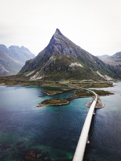
There is a moment, just as your FPV drone clears the knife-edge ridge of Reinebringen, where the world simply stops. Below you, the dramatic archipelago of Norway’s Lofoten Islands unfolds like a frozen, jagged spine rising directly out of the ink-black Norwegian Sea. Red fisherman’s cabins (rorbuer) huddle on tiny skerries, dwarfed by sheer granite walls that have stood against the Arctic storms for millennia.
For a travel writer and drone cinematographer, Lofoten isn’t just a destination; it’s the ultimate canvas.
The Legendary Climbs: Reinebringen & Ryten
1. Reinebringen: The Stairway to Heaven
Though standing at a modest 448 meters, Reinebringen is legendary. It is a grueling climb up 1,560 stone stairs built by Sherpas from Nepal. The effort is rewarded with a mind-blowing 360-degree view of the Reinefjord and the classic fishing villages of Hamnøy and Reine.
- Cinematographer’s Tip: Mid-afternoon light creates long, dramatic shadows across the fjord. Use a polarized filter to cut through the water’s reflection and reveal the vibrant turquoise reefs below.
2. Ryten and Kvalvika Beach
If Reinebringen is about the dramatic peaks, Ryten is about the collision of earth and ocean. The hike to Ryten takes you through lush, boggy meadows before ascending to a massive cliff edge hanging 543 meters directly above the isolated Kvalvika Beach.
- The View: Kvalvika is a crescent of golden sand hammered by massive Atlantic waves. From the summit of Ryten, the beach looks like a secret, untouched world.
Flying the Edge: FPV Cinematography in the Wild Arctic
Capturing Lofoten from an FPV (First-Person View) drone is both exhilarating and terrifying. The dramatic topography creates complex microclimates.
- Handling the Wind: Arctic winds can shift in seconds. When diving cliffs, always ensure you have enough battery and motor thrust to fight the updrafts on your return leg.
- Magnetic Interference: The massive basalt and granite rock formations contain high levels of iron, which can play havoc with your drone’s compass. Calibrate your GPS before taking off, and always be prepared to switch to full manual flight.
- Respecting Wildlife: Lofoten is home to thousands of sea eagles. Keep a sharp eye on the skies - these apex predators do not take kindly to plastic intruders.
Mapping Your Adventure
Use this interactive map to trace the dramatic landscape of the archipelago, from the northern beaches to the southern tip at Å:
Practical Tips for the Wild Explorer
- When to Visit: June to August offers the midnight sun - 24 hours of golden hour light. September to April is for the aurora hunters.
- Leave No Trace: The Arctic ecosystem is extremely fragile. Stick to the marked trails to prevent erosion of the thin soil layer.
- Layer Up: Even in summer, temperatures can hover around 8°C (46°F) with rain and gale-force winds.